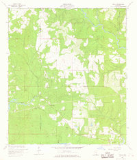
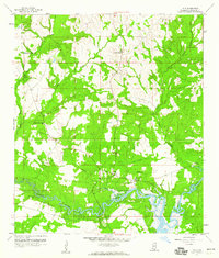
1956 Map of Vidalia
USGS Topo · Published 1968About this map
The Wolf River winds through the borderlands of Hancock and Harrison counties, defining a landscape of low-lying wetlands and pine forests in the mid-1950s. The settlement of Vidalia serves as the primary northern hub, while the southern reaches of the sheet touch the waters of St Louis Bay. This coastal hinterland is marked by a network of smaller drainages including Rotten Bayou, Bayou Le Salte, and Mill Creek, which dictated the early pattern of roads and homesteads.
Find a feature on this map
22 named features on this map. Tap any name to fly to it.
Don’t see what you’re looking for? This feature index may not catch every label — zoom into the map to look around manually.
Map Details
Editions of this 1956 Vidalia Map
5 editions found
Other maps of this area

1953 · Mobile
USGS Topo · 1:250,000

1954 · McHenry
USGS Topo · 1:62,500

1955 · Savannah
USGS Topo · 1:62,500

1955 · Pass Christian
USGS Topo · 1:24,000

1956 · Bay St. Louis
USGS Topo · 1:24,000

1956 · Vidalia
USGS Topo · 1:24,000

1956 · Waveland
USGS Topo · 1:24,000

1956 · Gulfport NW
USGS Topo · 1:24,000

1957 · Mobile
USGS Topo · 1:250,000
1959 · Kiln
USGS Topo · 1:24,000