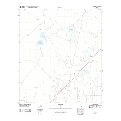
2010 Map of Vidaurri
USGS Topo · Published 2010About this map
Vidaurri sits as a central junction point in this Refugio County landscape, where the local rail corridor intersects with a network of rural roads and energy infrastructure. The surrounding coastal plain is defined by a series of significant water bodies, including the expansive Sharps Lake and the twin basins of North Saint Nicholas Lake and South Saint Nicholas Lake. The local economy and land use are clearly tied to both ranching and the petroleum industry, evidenced by the presence of Welder Ranch and the established drilling operations at the Greta Oil Field and West Vidauri Oil Field. These industrial sites and agricultural tracts are linked by a complex drainage system, with seasonal watercourses like Cottonwood Hollow feeding into the winding paths of Copano Creek and Melon Creek as they move toward the coast.
Find a feature on this map
10 named features on this map. Tap any name to fly to it.
Don’t see what you’re looking for? This feature index may not catch every label — zoom into the map to look around manually.
Map Details
Editions of this 2010 Vidaurri Map
This is the sole edition of this map. No revisions or reprints were ever made.
Other maps of this area

1953 · Beeville
USGS Topo · 1:250,000

1954 · Vidaurri
USGS Topo · 1:62,500

1954 · Refugio
USGS Topo · 1:62,500

1956 · Beeville
USGS Topo · 1:250,000

1960 · Beeville
USGS Topo · 1:250,000

1962 · Live Oak Lake
USGS Topo · 1:24,000

1962 · Lott Lake
USGS Topo · 1:24,000

1962 · McFaddin
USGS Topo · 1:24,000

1978 · Ryanville
USGS Topo · 1:24,000

1978 · Vidaurri
USGS Topo · 1:24,000