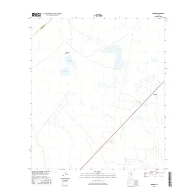
2016 Map of Vidaurri
USGS Topo · Published 2016About this map
Vidaurri sits as a primary point of reference in this coastal prairie landscape of Refugio County, where the intersection of Viddauri Rd and the main highway corridor anchors the small settlement. The terrain is defined by a complex network of seasonal water bodies and drainages, most notably N Saint Nicholas Lake and S Saint Nicholas Lake. These lakes, along with Cottonwood Hollow, illustrate the natural catchment basins common to this region of Texas, which feed into larger systems like Copano Cr and Melon Cr. The boundary between Goliad and Refugio counties cuts across the northwest corner of the map, marking a transition in local jurisdiction amidst a largely rural expanse of ranch land and private holdings. Rural access is maintained via routes such as Hawk Rd, which serves the agricultural and pastoral properties found throughout the quadrangle.
Find a feature on this map
9 named features on this map. Tap any name to fly to it.
Don’t see what you’re looking for? This feature index may not catch every label — zoom into the map to look around manually.
Map Details
Editions of this 2016 Vidaurri Map
This is the sole edition of this map. No revisions or reprints were ever made.
Other maps of this area

1953 · Beeville
USGS Topo · 1:250,000

1954 · Vidaurri
USGS Topo · 1:62,500

1954 · Refugio
USGS Topo · 1:62,500

1956 · Beeville
USGS Topo · 1:250,000

1960 · Beeville
USGS Topo · 1:250,000

1962 · Live Oak Lake
USGS Topo · 1:24,000

1962 · Lott Lake
USGS Topo · 1:24,000

1962 · McFaddin
USGS Topo · 1:24,000

1978 · Ryanville
USGS Topo · 1:24,000

1978 · Vidaurri
USGS Topo · 1:24,000