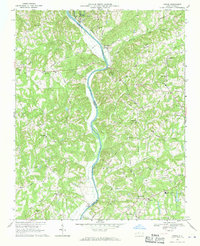
1968 Map of Vienna
USGS Topo · Published 1970About this map
The Yadkin River serves as the prominent divider for these northwest North Carolina borderlands, separating Yadkin and Surry counties from Forsyth. This late 1960s landscape is defined by its small crossroads settlements and numerous rural congregations, such as Union Hill Ch and New Bethel Cem Ch. The winding course of the river is followed by the Southern railroad line, which passes through the community of Donnaha.
Find a feature on this map
64 named features on this map. Tap any name to fly to it.
Don’t see what you’re looking for? This feature index may not catch every label — zoom into the map to look around manually.
Map Details
Editions of this 1968 Vienna Map
2 editions found
Other maps of this area

1891 · Yadkinville
USGS Topo · 1:125,000

1893 · Yadkinville
USGS Topo · 1:125,000

1950 · Winston-Salem West
USGS Topo · 1:24,000

1951 · Winston-Salem West
USGS Topo · 1:24,000

1951 · Rural Hall
USGS Topo · 1:24,000

1953 · Winston-Salem
USGS Topo · 1:250,000

1955 · Winston-Salem
USGS Topo · 1:250,000

1962 · Winston-Salem
USGS Topo · 1:250,000

1964 · Pinnacle
USGS Topo · 1:24,000

1964 · King
USGS Topo · 1:24,000