
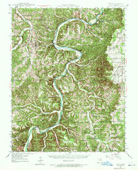
1937 Map of Vienna
USGS Topo · Published 1964About this map
The Gasconade River and Maries River carve through the central Missouri landscape, defining the character of this late-1930s survey. At Vienna, the seat of Maries County, the terrain is marked by a complex network of hollows and ridges like Turkey Hollow and Pea Hollow. This era is characterized by an extensive system of rural education and river crossings that have since evolved, featuring numerous local landmarks such as Little Flock Sch, Paydown Sch, and Bend Sch.
Find a feature on this map
90 named features on this map. Tap any name to fly to it.
Don’t see what you’re looking for? This feature index may not catch every label — zoom into the map to look around manually.
Map Details
Editions of this 1937 Vienna Map
2 editions found
Other maps of this area

1888 · Tuscumbia
USGS Topo · 1:125,000

1894 · Tuscumbia
USGS Topo · 1:125,000

1912 · Rolla
USGS Topo · 1:62,500

1928 · Meramec Spring
USGS Topo · 1:62,500

1934 · Linn
USGS Topo · 1:48,000

1934 · Bland
USGS Topo · 1:62,500

1934 · Redbird
USGS Topo · 1:62,500

1936 · Waynesville
USGS Topo · 1:48,000

1937 · Bland
USGS Topo · 1:62,500

1938 · Redbird
USGS Topo · 1:62,500