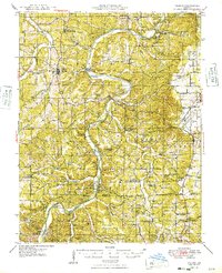
1949 Map of Vienna
USGS Topo · Published 1949About this map
The Gasconade River and its winding tributaries dominate this landscape in the late 1930s, revealing a rural network of river crossings and small community centers. River commerce and travel are evidenced by traditional points of passage like Gaines Ferry and Gaines Ford, while leisure and tourism appear at Indian Ford Lodge and Nagogami Lodge. The settlement of Vienna serves as a primary hub, supported by a dense distribution of one-room schoolhouses such as Little Flock Sch and Bend Sch that anchored local life before the era of district consolidation.
Find a feature on this map
111 named features on this map. Tap any name to fly to it.
Don’t see what you’re looking for? This feature index may not catch every label — zoom into the map to look around manually.
Map Details
Editions of this 1949 Vienna Map
2 editions found

Other maps of this area

1888 · Tuscumbia
USGS Topo · 1:125,000

1894 · Tuscumbia
USGS Topo · 1:125,000

1912 · Rolla
USGS Topo · 1:62,500

1928 · Meramec Spring
USGS Topo · 1:62,500

1934 · Linn
USGS Topo · 1:48,000

1934 · Bland
USGS Topo · 1:62,500

1934 · Redbird
USGS Topo · 1:62,500

1936 · Waynesville
USGS Topo · 1:48,000

1937 · Bland
USGS Topo · 1:62,500

1937 · Vienna
USGS Topo · 1:62,500