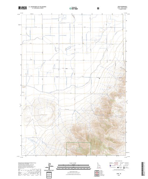
2024 Map of View
USGS Topo · Published 2024About this map
View and its surrounding agricultural lands are defined by a complex network of irrigation infrastructure in this southern Idaho landscape. The map reveals an intricate system of laterals and drains, such as the H Canal, J Canal, and Rassmussen Drain, which transform the arid plains into productive fields. This human-managed water system terminates at the base of the Albion Mountains, where the terrain rises sharply toward the southern border. Within this higher elevation, the Sawtooth National Forest encompasses prominent summits including Pine Knob and Antelope Hill. Local history is anchored by the View Cem and the small settlement along Mountain View Ln, illustrating the close relationship between 21st-century rural habitation and the high-desert environment. The contrast between the rigid grid of roads like E 600 S and the winding course of White Creek emphasizes the transition from reclaimed farmland to natural wilderness.
Find a feature on this map
54 named features on this map. Tap any name to fly to it.
Don’t see what you’re looking for? This feature index may not catch every label — zoom into the map to look around manually.
Map Details
Editions of this 2024 View Map
This is the sole edition of this map. No revisions or reprints were ever made.
Other maps of this area

1954 · Pocatello
USGS Topo · 1:250,000

1958 · Pocatello
USGS Topo · 1:250,000

1964 · Rupert SE
USGS Topo · 1:24,000

1964 · View
USGS Topo · 1:24,000

1964 · Kenyon
USGS Topo · 1:24,000

1964 · Rupert SW
USGS Topo · 1:24,000

1964 · Burley SE
USGS Topo · 1:24,000

1968 · Marion SE
USGS Topo · 1:24,000

1968 · Mount Harrison
USGS Topo · 1:24,000

1968 · Albion
USGS Topo · 1:24,000