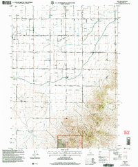
2001 Map of View
USGS Topo · Published 2006About this map
View and the surrounding agricultural lands of southern Idaho are defined by a meticulous grid of section roads and vital irrigation infrastructure. The landscape transitions from the developed flats, where Unity Ch and the Grange Hall served as community pillars, into the rising topography of the Sawtooth National Forest. This shift is marked by the transition from human-engineered water systems like the Snipe Gulch Drain and Rassmussen Drain to the natural drainage of Big Rocky Creek and Smith Creek. Genealogists and local historians can pinpoint family-linked locations including the Marchant settlement and the View Cem. The presence of numerous corrals throughout the southern section near Antelope Hill underscores the area's enduring ranching economy at the opening of the 21st century, illustrating how land use was partitioned between irrigated farming and upland grazing.
Find a feature on this map
31 named features on this map. Tap any name to fly to it.
Don’t see what you’re looking for? This feature index may not catch every label — zoom into the map to look around manually.
Map Details
Editions of this 2001 View Map
This is the sole edition of this map. No revisions or reprints were ever made.
Other maps of this area

1954 · Pocatello
USGS Topo · 1:250,000

1958 · Pocatello
USGS Topo · 1:250,000

1964 · Rupert SE
USGS Topo · 1:24,000

1964 · View
USGS Topo · 1:24,000

1964 · Kenyon
USGS Topo · 1:24,000

1964 · Rupert SW
USGS Topo · 1:24,000

1964 · Burley SE
USGS Topo · 1:24,000

1968 · Marion SE
USGS Topo · 1:24,000

1968 · Mount Harrison
USGS Topo · 1:24,000

1968 · Albion
USGS Topo · 1:24,000