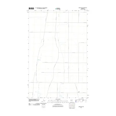
2010 Map of Viking SW
USGS Topo · Published 2010About this map
The Black River meanders through this portion of Polk County, defining the drainage patterns of an otherwise straight-gridded agricultural landscape. This 2010 survey shows a region largely organized by its county highway system, yet it retains clear markers of its older transit history through the multiple segments of the Pembina Trl, including the Pembina Trl Nw and Pembina Trl Sw. These diagonal paths cut across the modern section lines, tracing a historic cart route that predates the formal road network. Near the southern edge of the map, the Black River Cemetery sits close to the river's banks, serving as a primary genealogical landmark for the surrounding rural community. Other notable water features include the isolated Goose Lake, which breaks up the vast network of township roads like Center St W and 10th Ave NW.
Find a feature on this map
22 named features on this map. Tap any name to fly to it.
Don’t see what you’re looking for? This feature index may not catch every label — zoom into the map to look around manually.
Map Details
Editions of this 2010 Viking SW Map
This is the sole edition of this map. No revisions or reprints were ever made.
Other maps of this area

1918 · Angus
USGS Topo · 1:62,500

1918 · Red Lake Falls
USGS Topo · 1:62,500

1918 · Viking
USGS Topo · 1:62,500

1952 · Red Lake Falls
USGS Topo · 1:62,500

1952 · Grand Forks
USGS Topo · 1:250,000

1952 · Thief River Falls
USGS Topo · 1:250,000

1953 · Crookston
USGS Topo · 1:62,500

1956 · Thief River Falls
USGS Topo · 1:250,000

1956 · Grand Forks
USGS Topo · 1:250,000

1957 · Thief River Falls
USGS Topo · 1:250,000