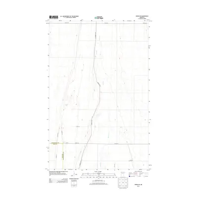
2013 Map of Viking SW
USGS Topo · Published 2013About this map
The Black River meanders through this portion of the Red River Valley, defining the boundary between Pennington and Polk counties. The landscape is characterized by a grid of rural roads and the historical corridor of the Pembina Trl, which follows the north-south elevation changes in the terrain. Near the southern edge of the survey, the Black River Cem serves as a significant local landmark for genealogists and family historians researching the settlement of this agricultural region. To the west, the marshy waters of Goose Lake break the regularity of the section lines, indicating the low-lying nature of the local hydrology. This 2013 survey provides a clear view of the modern road network, including Co Hwy-3 and Center St W, overlaid on the traditional township and range divisions of Northwest Minnesota.
Find a feature on this map
14 named features on this map. Tap any name to fly to it.
Don’t see what you’re looking for? This feature index may not catch every label — zoom into the map to look around manually.
Map Details
Editions of this 2013 Viking SW Map
This is the sole edition of this map. No revisions or reprints were ever made.
Other maps of this area

1918 · Angus
USGS Topo · 1:62,500

1918 · Red Lake Falls
USGS Topo · 1:62,500

1918 · Viking
USGS Topo · 1:62,500

1952 · Red Lake Falls
USGS Topo · 1:62,500

1952 · Grand Forks
USGS Topo · 1:250,000

1952 · Thief River Falls
USGS Topo · 1:250,000

1953 · Crookston
USGS Topo · 1:62,500

1956 · Thief River Falls
USGS Topo · 1:250,000

1956 · Grand Forks
USGS Topo · 1:250,000

1957 · Thief River Falls
USGS Topo · 1:250,000