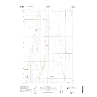
2019 Map of Viking SW
USGS Topo · Published 2019About this map
Black River meanders through this portion of the Red River Valley, defining a landscape of low-lying wetlands and prairie on the boundary of Pennington and Polk counties. The map documents a significant historical transportation corridor following the Pembina Trail, also labeled as Pembina Trl Nw in various sections. This historic oxcart route, once a vital link between the Red River Colony and the Mississippi River, runs parallel to the modern drainage of Goose Lake Swamp. The rural character of the area is anchored by the Black River Cem near the southern edge of the survey, serving the local farming community defined by a rigid section-line road network including Center St W and Co Hwy 8. The persistence of water features like Goose Lake amidst the agricultural grid illustrates the enduring hydrology of this glacial lake plain.
Find a feature on this map
27 named features on this map. Tap any name to fly to it.
Don’t see what you’re looking for? This feature index may not catch every label — zoom into the map to look around manually.
Map Details
Editions of this 2019 Viking SW Map
This is the sole edition of this map. No revisions or reprints were ever made.
Other maps of this area

1918 · Angus
USGS Topo · 1:62,500

1918 · Red Lake Falls
USGS Topo · 1:62,500

1918 · Viking
USGS Topo · 1:62,500

1952 · Red Lake Falls
USGS Topo · 1:62,500

1952 · Grand Forks
USGS Topo · 1:250,000

1952 · Thief River Falls
USGS Topo · 1:250,000

1953 · Crookston
USGS Topo · 1:62,500

1956 · Thief River Falls
USGS Topo · 1:250,000

1956 · Grand Forks
USGS Topo · 1:250,000

1957 · Thief River Falls
USGS Topo · 1:250,000