Loading...
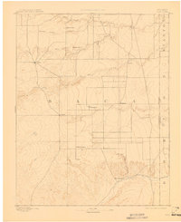
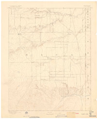
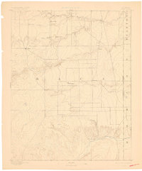
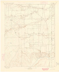
Loading map...1892 Map of Vilas
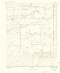
USGS Topo · Published 1911About this map
Texas Trail cuts across the high plains of southeastern Colorado in this 1890 survey, marking a significant corridor for cattle drives and migration toward the Colorado Kansas Boundary Line. The landscape of Baca County is defined by a sparse network of early settlements including Vilas, Stonington, and Boston, alongside established family landmarks like Mathews Ranch and Miles Ranch.
Find a feature on this map
22 named features on this map. Tap any name to fly to it.
Don’t see what you’re looking for? This feature index may not catch every label — zoom into the map to look around manually.
Map Details
Date Portrayed1892
Date Published1911
PublisherU.S. Geological Survey
Map TypeTopographic
Scale1:125,000
Physical Dimensions16.5 x 20.2 inches
Editions of this 1892 Vilas Map
5 editions found
Historical Maps of Walsh Through Time
1 maps found
Featured Locations
Source Details
SourceU.S. Geological Survey
CopyrightPublic Domain