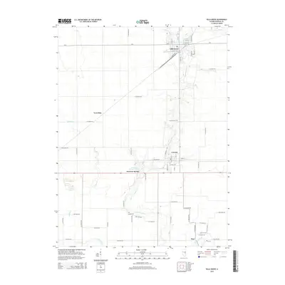
2015 Map of Villa Grove
USGS Topo · Published 2015About this map
The Embarras River valley anchors this portion of Douglas County, winding past several established settlements including Villa Grove, Camargo, and Hugo. The landscape is a study in Midwestern agricultural geometry, where the township and range system is clearly defined by a dense grid of rural roads such as E 1000 North Rd and N 1250 East Rd. For genealogists, the map is particularly useful for locating family plots at sites like Hammett Cem, Oak Ridge Cem, Broadus Cem, and Antioch Cem. The presence of Patterson Springs and Patterson Springs Lake suggests a localized focus on water resources and recreation amidst the surrounding farmland. Rail history is still visible in the layout of the city center of Villa Grove, where N Railroad St runs parallel to the tracks, influencing the town's orientation along the river.
Find a feature on this map
60 named features on this map. Tap any name to fly to it.
Don’t see what you’re looking for? This feature index may not catch every label — zoom into the map to look around manually.
Map Details
Editions of this 2015 Villa Grove Map
This is the sole edition of this map. No revisions or reprints were ever made.
Other maps of this area

1935 · Arcola
USGS Topo · 1:48,000

1936 · Oakland
USGS Topo · 1:48,000

1940 · Arcola
USGS Topo · 1:62,500

1942 · Oakland
USGS Topo · 1:62,500

1950 · Tuscola
USGS Topo · 1:62,500

1956 · Villa Grove
USGS Topo · 1:62,500

1958 · Decatur
USGS Topo · 1:250,000

1961 · Decatur
USGS Topo · 1:250,000
1975 · Tuscola NE
USGS Topo · 1:24,000

1975 · Tuscola SE
USGS Topo · 1:24,000