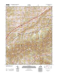
2013 Map of Villamont
USGS Topo · Published 2013About this map
Villamont and the nearby community of Blue Ridge anchor the southern reaches of this landscape, situated along the corridor of S Fork Goose Cr. The terrain is defined by a series of prominent rises and gaps, including Grindstone Knob, Blue Knob, and Wildcat Knob, which overlook the surrounding valleys. Historical transit and commerce are evident in the density of named roads and landmarks such as Camp Bethel and the Wilson Creek Shelter.
Find a feature on this map
109 named features on this map. Tap any name to fly to it.
Don’t see what you’re looking for? This feature index may not catch every label — zoom into the map to look around manually.
Map Details
Editions of this 2013 Villamont Map
This is the sole edition of this map. No revisions or reprints were ever made.
Other maps of this area

1890 · Roanoke
USGS Topo · 1:125,000

1891 · Roanoke
USGS Topo · 1:125,000

1894 · Natural Bridge
USGS Topo · 1:125,000

1894 · Natural Bridge
USGS Topo · 1:62,500

1907 · Natural Bridge Special
USGS Topo · 1:62,500

1913 · Eagle Rock
USGS Topo · 1:48,000

1915 · Eagle Rock
USGS Topo · 1:62,500

1929 · Roanoke
USGS Topo · 1:48,000

1933 · Roanoke
USGS Topo · 1:62,500

1947 · Roanoke
USGS Topo · 1:250,000