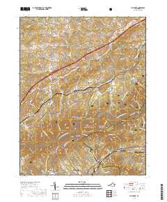
2019 Map of Villamont
USGS Topo · Published 2019About this map
Fincastle and Troutville anchor this survey of the terrain where the valley meets the mountains of the Jefferson National Forest. The landscape is defined by the ridge-and-valley topography, with the Appalachian National Scenic Trail and the Blue Ridge Parkway winding along high elevations through Curry Gap and past Grindstone Knob. In the lowlands, small settlements like Nace, Lithia, and Villamont sit along a network of creek drainages including Mill Cr and Back Cr. Local family history is preserved in small burial grounds such as Thompson Cemeteries, Booze Cem, and Simmons Cem. The area illustrates a 21st-century transition between developed town corridors and protected federal forest lands, marked by prominent peaks like Blue Knob and Wildcat Knob.
Find a feature on this map
108 named features on this map. Tap any name to fly to it.
Don’t see what you’re looking for? This feature index may not catch every label — zoom into the map to look around manually.
Map Details
Editions of this 2019 Villamont Map
This is the sole edition of this map. No revisions or reprints were ever made.
Other maps of this area

1890 · Roanoke
USGS Topo · 1:125,000

1891 · Roanoke
USGS Topo · 1:125,000

1894 · Natural Bridge
USGS Topo · 1:125,000

1894 · Natural Bridge
USGS Topo · 1:62,500

1907 · Natural Bridge Special
USGS Topo · 1:62,500

1913 · Eagle Rock
USGS Topo · 1:48,000

1915 · Eagle Rock
USGS Topo · 1:62,500

1929 · Roanoke
USGS Topo · 1:48,000

1933 · Roanoke
USGS Topo · 1:62,500

1947 · Roanoke
USGS Topo · 1:250,000