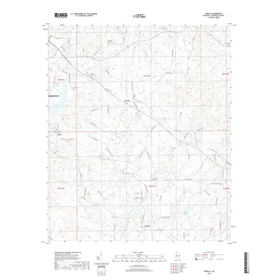
2018 Map of Vimville
USGS Topo · Published 2018About this map
The crossroads of Vimville and nearby Enzor anchor this survey of eastern Lauderdale County, where the hills are defined by the intricate headwaters of Buckatunna Cr and Alamuchee Cr. The settlement patterns here follow a dense network of early thoroughfares such as Old Wire Rd and the Vimville Causeyville Rd, tracing the movement between family farms and rural centers. Genealogists will find a concentrated cluster of burial grounds across the landscape, including Tabernacle Cem, Pleasant Grove Cem, and Coker Chapel Cem, reflecting the deep-rooted community history of the area. To the south, the village of Increase sits near the confluence of several branches, while the northern reaches transition toward the outskirts of Meridian. The presence of McRae Lake and various reservoirs indicates a reliance on managed water resources for local industry and agriculture in this part of Mississippi.
Find a feature on this map
86 named features on this map. Tap any name to fly to it.
Don’t see what you’re looking for? This feature index may not catch every label — zoom into the map to look around manually.
Map Details
Editions of this 2018 Vimville Map
This is the sole edition of this map. No revisions or reprints were ever made.
Other maps of this area

1921 · Meridian
USGS Topo · 1:48,000

1923 · Meridian
USGS Topo · 1:62,500

1953 · Meridian
USGS Topo · 1:250,000

1957 · Meridian
USGS Topo · 1:250,000

1957 · Quitman
USGS Topo · 1:62,500

1965 · Meridian
USGS Topo · 1:250,000

1971 · Vimville
USGS Topo · 1:24,000

1971 · Meridian South
USGS Topo · 1:24,000

1971 · Meridian North
USGS Topo · 1:24,000
1971 · Toomsuba
USGS Topo · 1:24,000