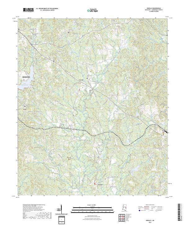
2024 Map of Vimville
USGS Topo · Published 2024About this map
Vimville and the surrounding rural communities of Lauderdale County appear in high detail during this modern survey, which documents the landscape east of Meridian. The terrain is defined by a dense network of tributaries including Buckatunna Creek and Alamuchee Creek, interspersed with small settlements like Increase and Enzor. For local historians and genealogists, the map provides precise locations for several community centers, such as Coker Chapel Cem and Mount Carmel Cem, alongside family-named landmarks like Linton Rd and Rufus Martin Rd. The presence of the Long Creek Reservoir and smaller water bodies like McRae Lake highlight the area's hydrology, while the many named county roads reveal the modern connectivity of these historically timber-and-agriculture-reliant regions.
Find a feature on this map
83 named features on this map. Tap any name to fly to it.
Don’t see what you’re looking for? This feature index may not catch every label — zoom into the map to look around manually.
Map Details
Editions of this 2024 Vimville Map
This is the sole edition of this map. No revisions or reprints were ever made.
Other maps of this area

1921 · Meridian
USGS Topo · 1:48,000

1923 · Meridian
USGS Topo · 1:62,500

1953 · Meridian
USGS Topo · 1:250,000

1957 · Meridian
USGS Topo · 1:250,000

1957 · Quitman
USGS Topo · 1:62,500

1965 · Meridian
USGS Topo · 1:250,000

1971 · Vimville
USGS Topo · 1:24,000

1971 · Meridian South
USGS Topo · 1:24,000

1971 · Meridian North
USGS Topo · 1:24,000
1971 · Toomsuba
USGS Topo · 1:24,000