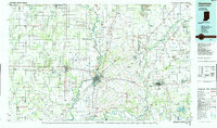
1986 Map of Vincennes
USGS Topo · Published 1986About this map
The Wabash River serves as the central artery for this mid-1980s landscape, winding past Vincennes and defining much of the Illinois-Indiana state line. The map illustrates a dense network of heavy infrastructure, including the regional hub of Vincennes University and major transportation nodes like the Lawrenceville-Vincennes International Airport. Extensive rail lines, such as the Baltimore and Ohio Railroad and the Milwaukee Road, intersect at the historic river crossings, highlighting the area's continued importance as a transit corridor.
Find a feature on this map
149 named features on this map. Tap any name to fly to it.
Don’t see what you’re looking for? This feature index may not catch every label — zoom into the map to look around manually.
Map Details
Editions of this 1986 Vincennes Map
2 editions found
Other maps of this area

1901 · Princeton
USGS Topo · 1:62,500

1902 · Ditney
USGS Topo · 1:125,000

1903 · Velpen
USGS Topo · 1:62,500

1903 · Petersburg
USGS Topo · 1:62,500

1903 · Princeton
USGS Topo · 1:62,500

1903 · Patoka
USGS Topo · 1:125,000

1904 · Mount Carmel
USGS Topo · 1:62,500

1908 · Bloomfield
USGS Topo · 1:62,500

1910 · Hardinville
USGS Topo · 1:62,500

1911 · Sumner
USGS Topo · 1:62,500