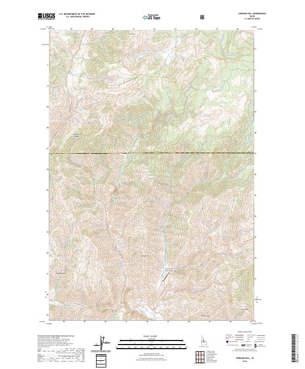
2024 Map of Vinegar Hill
USGS Topo · Published 2024About this map
Frank Church-River of No Return Wilderness and Payette National Forest encompass this remote landscape along the border of Idaho and Valley counties. The terrain is defined by dramatic elevation changes between high peaks like Cold Mtn and Horse Mtn and deep drainage basins such as Towhead Basin. The local aviation and transport infrastructure is represented by the Cabin Creek USFS Airport, providing critical access to this wilderness area. A network of specialized paths, including the Coyote Spring/Cow Creek Trl and Big Creek Trl, illustrates the reliance on trail-based movement through the Cold Mountain Ridge and across gaps like Blackburn Saddle. The map documents numerous water sources, from the South Fork Cottonwood Creek in the north to Big Creek in the south, which have shaped the movement and naming of this high-country territory.
Find a feature on this map
36 named features on this map. Tap any name to fly to it.
Don’t see what you’re looking for? This feature index may not catch every label — zoom into the map to look around manually.
Map Details
Editions of this 2024 Vinegar Hill Map
This is the sole edition of this map. No revisions or reprints were ever made.
Other maps of this area

1956 · Elk City
USGS Topo · 1:250,000

1960 · Elk City
USGS Topo · 1:250,000

1962 · Mormon Mtn
USGS Topo · 1:24,000

1962 · Vinegar Hill
USGS Topo · 1:24,000

1962 · Papoose Peak
USGS Topo · 1:24,000

1962 · Dave Lewis Peak
USGS Topo · 1:24,000

1973 · Acorn Butte
USGS Topo · 1:24,000
1973 · Monument
USGS Topo · 1:24,000

1977 · Cottonwood Butte
USGS Topo · 1:24,000

1978 · Wapiti Creek
USGS Topo · 1:24,000