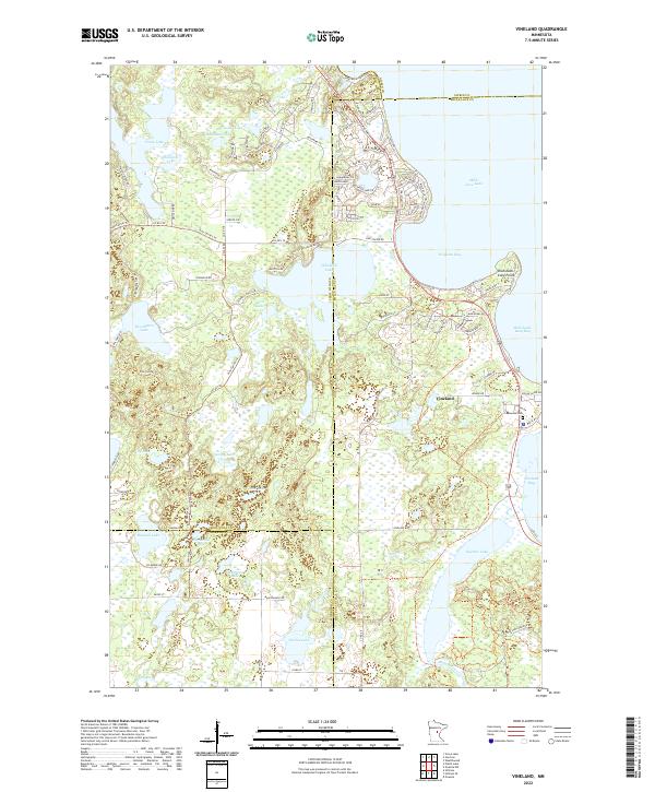
2022 Map of Vineland
USGS Topo · Published 2022About this map
The settlement of Vineland sits prominently along the western shores of Mille Lacs Lake, marking a landscape where water and woodland dominate the geography. This 2022 survey captures the intricate shoreline of Wigwam Bay and Vineland Bay, featuring the prominent Shah-bush-kung Point that extends into the lake. To the south, the Rum River flows out of Ogechie Lake, a critical hydrological connection for the region.
Find a feature on this map
106 named features on this map. Tap any name to fly to it.
Don’t see what you’re looking for? This feature index may not catch every label — zoom into the map to look around manually.
Map Details
Editions of this 2022 Vineland Map
This is the sole edition of this map. No revisions or reprints were ever made.
Other maps of this area

1912 · Deerwood
USGS Topo · 1:62,500

1914 · Deerwood
USGS Topo · 1:62,500

1916 · Wealthwood
USGS Topo · 1:62,500

1953 · Duluth
USGS Topo · 1:250,000

1958 · Duluth
USGS Topo · 1:250,000

1968 · Onamia NW
USGS Topo · 1:24,000

1968 · Onamia
USGS Topo · 1:24,000
1968 · Platte Lake
USGS Topo · 1:24,000
1968 · Vineland
USGS Topo · 1:24,000
1968 · Hillman
USGS Topo · 1:24,000