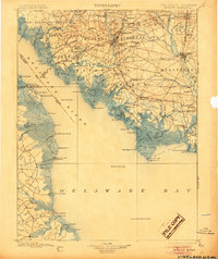
1899 Map of Vineland
USGS Topo · Published 1905About this map
Bridgeton serves as a central hub on this late 19th-century survey, where the Central R. R. of New Jersey and multiple branches of the West Jersey and Seashore R. R. converge to support the regional glass and agricultural industries. The map illustrates a complex network of coastal settlements and maritime infrastructure along the Cohansey River and the Maurice River, leading down to the oyster-harvesting center of Bivalve.
Find a feature on this map
186 named features on this map. Tap any name to fly to it.
Don’t see what you’re looking for? This feature index may not catch every label — zoom into the map to look around manually.
Map Details
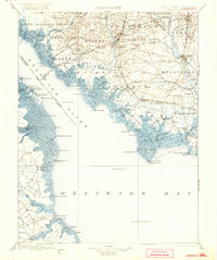
Editions of this 1899 Vineland Map
3 editions found

Other maps of this area

1888 · Cape May
USGS Topo · 1:62,500

1888 · Dennisville
USGS Topo · 1:62,500

1890 · Hammonton
USGS Topo · 1:62,500

1890 · Salem
USGS Topo · 1:62,500

1890 · Tuckahoe
USGS Topo · 1:62,500

1890 · Maurice Cove
USGS Topo · 1:62,500

1890 · Bay Side
USGS Topo · 1:62,500

1890 · Bridgeton
USGS Topo · 1:62,500

1890 · Glassboro
USGS Topo · 1:62,500

1891 · Maurice Cove
USGS Topo · 1:62,500