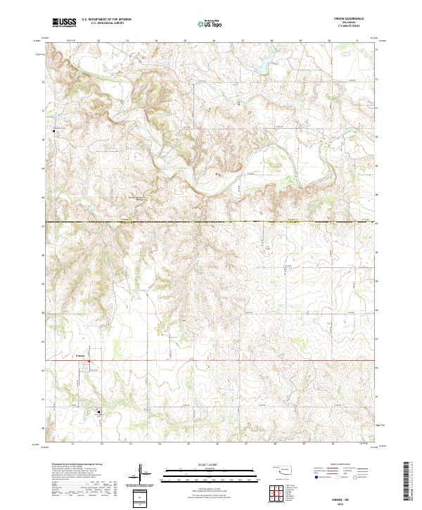
2022 Map of Vinson
USGS Topo · Published 2022About this map
Vinson serves as the focal point for this Southwest Oklahoma landscape, situated just south of the Greer Co Harmon Co boundary line. The topography is defined by the erosion of several watercourses, most notably Hackberry Cr in the northwest and the winding path of Cave Cr in the south. A rare geologic landmark, the Vinson Natural Bridge, is located north of the town, illustrating the unique karst or gypsum-rich limestone formations common to this region.
Find a feature on this map
35 named features on this map. Tap any name to fly to it.
Don’t see what you’re looking for? This feature index may not catch every label — zoom into the map to look around manually.
Map Details
Editions of this 2022 Vinson Map
This is the sole edition of this map. No revisions or reprints were ever made.
Other maps of this area

1955 · Lawton
USGS Topo · 1:250,000

1955 · Clinton
USGS Topo · 1:250,000

1957 · Clinton
USGS Topo · 1:250,000

1961 · Willow
USGS Topo · 1:62,500

1961 · Erick
USGS Topo · 1:62,500

1971 · Russell
USGS Topo · 1:24,000
1971 · Madge
USGS Topo · 1:24,000

1971 · Vinson
USGS Topo · 1:24,000
1971 · Mc Knight
USGS Topo · 1:24,000

1971 · Reed
USGS Topo · 1:24,000