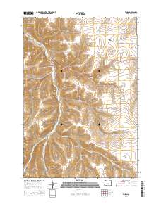
2014 Map of Vinson
USGS Topo · Published 2014About this map
Vinson serves as the focal point for this section of Umatilla County, situated along the banks of Butter Cr. The landscape is defined by a dense network of drainage systems, where deep ravines like Vinson Canyon and Rancheree Canyon carve into the high plateau. Genealogists and local historians will find the Vinson Cem positioned near the settlement, marking the presence of early residents in this agricultural corridor. The map reveals a transition from the narrow valley floors to broad upland areas such as Whittaker Flats, reflecting the region's reliance on these varied landforms for ranching and passage.
Find a feature on this map
33 named features on this map. Tap any name to fly to it.
Don’t see what you’re looking for? This feature index may not catch every label — zoom into the map to look around manually.
Map Details
Editions of this 2014 Vinson Map
This is the sole edition of this map. No revisions or reprints were ever made.
Other maps of this area

1908 · Umatilla
USGS Topo · 1:125,000

1935 · Pendleton
USGS Topo · 1:125,000

1953 · Pendleton
USGS Topo · 1:250,000

1956 · Pendleton
USGS Topo · 1:250,000
1966 · Coombs Canyon
USGS Topo · 1:24,000

1967 · Nye
USGS Topo · 1:24,000

1967 · Carney Butte
USGS Topo · 1:24,000

1968 · Hoodlum Canyon
USGS Topo · 1:24,000
1968 · Echo SE
USGS Topo · 1:24,000

1968 · Gurdane
USGS Topo · 1:24,000