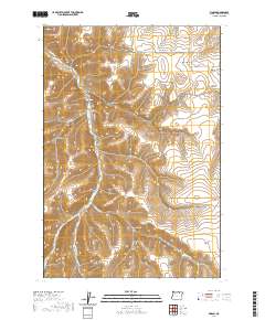
2020 Map of Vinson
USGS Topo · Published 2020About this map
Vinson Cem sits above the confluence of deep drainage systems in this part of Umatilla County, marking the namesake canyon and the legacy of early ranching and homesteading. The landscape is defined by the winding course of Butter Cr and its tributaries, including E Fork Butter Cr and the Webb Slough. These watercourses have carved a complex network of canyons such as Dixie Canyon, Rancheree Canyon, and Alkali Canyon, creating a topography where high plateaus like Whittaker Flats contrast sharply with steep draws like Hog Hollow. This 2020 survey reveals the modern infrastructure of the high desert, where established routes like Butter Creek Rd and Gurdane Rd follow the natural contours of the land, providing access to remote agricultural and grazing lands that have shaped the regional economy for over a century.
Find a feature on this map
34 named features on this map. Tap any name to fly to it.
Don’t see what you’re looking for? This feature index may not catch every label — zoom into the map to look around manually.
Map Details
Editions of this 2020 Vinson Map
This is the sole edition of this map. No revisions or reprints were ever made.
Other maps of this area

1908 · Umatilla
USGS Topo · 1:125,000

1935 · Pendleton
USGS Topo · 1:125,000

1953 · Pendleton
USGS Topo · 1:250,000

1956 · Pendleton
USGS Topo · 1:250,000
1966 · Coombs Canyon
USGS Topo · 1:24,000

1967 · Nye
USGS Topo · 1:24,000

1967 · Carney Butte
USGS Topo · 1:24,000

1968 · Hoodlum Canyon
USGS Topo · 1:24,000
1968 · Echo SE
USGS Topo · 1:24,000

1968 · Gurdane
USGS Topo · 1:24,000