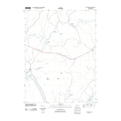
2010 Map of Vintondale
USGS Topo · Published 2010About this map
Vintondale and the neighboring settlements of Rexis and Wehrum sit along the South Branch Blacklick Creek, marking a landscape shaped by coal-era industry and steep Appalachian geography. In the southern portion of the map, the Conemaugh River carves the deep Conemaugh Gorge through Laurel Ridge, a significant natural feature that dictated early transportation routes. Local history is evidenced by the site of the Conemaugh Furnace near Cramer, pointing to the region's long association with iron and steel production. Water management is a primary theme of the terrain, with numerous impoundments including Findley Run Reservoir, Big Spring Reservoir, and Hinckston Run Reservoir supplying the industrial and residential needs of the surrounding valley. The Charles F Lewis Natural Area preserves a portion of Rager Mountain, showing the high-relief woodland that separates these river-bottom towns.
Find a feature on this map
75 named features on this map. Tap any name to fly to it.
Don’t see what you’re looking for? This feature index may not catch every label — zoom into the map to look around manually.
Map Details
Editions of this 2010 Vintondale Map
This is the sole edition of this map. No revisions or reprints were ever made.
Other maps of this area

1902 · Indiana
USGS Topo · 1:62,500

1902 · Barnesboro
USGS Topo · 1:62,500

1904 · Barnesboro
USGS Topo · 1:62,500

1904 · Johnstown
USGS Topo · 1:62,500

1907 · Johnstown
USGS Topo · 1:62,500

1920 · New Florence
USGS Topo · 1:62,500

1921 · New Florence
USGS Topo · 1:48,000

1922 · New Florence
USGS Topo · 1:62,500

1943 · Punxsutawney
USGS Topo · 1:125,000

1944 · New Florence
USGS Topo · 1:62,500
Featured Places
- Vintondale, PA
- Cramer, East Wheatfield Township
- West Taylor Township, PA
- Wehrum, Buffington Township
- Saint Clair Township, PA