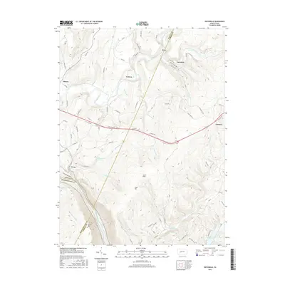
2016 Map of Vintondale
USGS Topo · Published 2016About this map
Vintondale and the surrounding coal-country settlements of Wehrum and Rexis anchor this 2016 survey along the borders of Cambria, Indiana, and Westmoreland counties. The landscape is defined by the steep elevation of Laurel Ridge and Rager Mtn, where the Conemaugh River carves the prominent Conemaugh Gorge in the southwest. A network of waterways including Blacklick Creek and the North Branch Blacklick Creek supported the local industrial history, evidenced by the proximity of Oneida Mine Rd and the Coke Oven Rd. Water management for the region is highly visible through several major impoundments, most notably the Findley Run Reservoir, Laurel Run Reservoir, and Hinckston Run Reservoir. This modern record of the terrain preserves the footprint of early industrial access roads and small mining-era communities while documenting the reforestation of the ridges.
Find a feature on this map
82 named features on this map. Tap any name to fly to it.
Don’t see what you’re looking for? This feature index may not catch every label — zoom into the map to look around manually.
Map Details
Editions of this 2016 Vintondale Map
This is the sole edition of this map. No revisions or reprints were ever made.
Other maps of this area

1902 · Indiana
USGS Topo · 1:62,500

1902 · Barnesboro
USGS Topo · 1:62,500

1904 · Barnesboro
USGS Topo · 1:62,500

1904 · Johnstown
USGS Topo · 1:62,500

1907 · Johnstown
USGS Topo · 1:62,500

1920 · New Florence
USGS Topo · 1:62,500

1921 · New Florence
USGS Topo · 1:48,000

1922 · New Florence
USGS Topo · 1:62,500

1943 · Punxsutawney
USGS Topo · 1:125,000

1944 · New Florence
USGS Topo · 1:62,500
Featured Places
- Vintondale, PA
- Cramer, East Wheatfield Township
- West Taylor Township, PA
- Wehrum, Buffington Township
- Saint Clair Township, PA