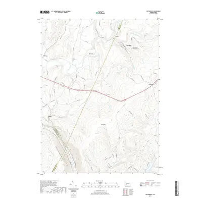
2019 Map of Vintondale
USGS Topo · Published 2019About this map
Vintondale and the surrounding coal-country settlements occupy the valley floor where the North Branch Blacklick Creek and South Branch Blacklick Creek converge. The landscape is defined by the massive elevation changes of Laurel Ridge and Rager Mtn, which force the waterways into deep incisions like the Conemaugh Gorge. This topography dictated the development of isolated company towns and hamlets, including Wehrum and Rexis, connected by roads winding through the gaps. Cultural landmarks such as the Saints Peter and Paul Orthodox Church of America Cem in Vintondale and the Black Lick Cem near Wehrum provide essential touchstones for genealogical research. The presence of the Findley Run Reservoir and Big Spring Reservoir highlight the region's managed water resources amidst the steep, wooded terrain of Laurel Hill.
Find a feature on this map
86 named features on this map. Tap any name to fly to it.
Don’t see what you’re looking for? This feature index may not catch every label — zoom into the map to look around manually.
Map Details
Editions of this 2019 Vintondale Map
This is the sole edition of this map. No revisions or reprints were ever made.
Other maps of this area

1902 · Indiana
USGS Topo · 1:62,500

1902 · Barnesboro
USGS Topo · 1:62,500

1904 · Barnesboro
USGS Topo · 1:62,500

1904 · Johnstown
USGS Topo · 1:62,500

1907 · Johnstown
USGS Topo · 1:62,500

1920 · New Florence
USGS Topo · 1:62,500

1921 · New Florence
USGS Topo · 1:48,000

1922 · New Florence
USGS Topo · 1:62,500

1943 · Punxsutawney
USGS Topo · 1:125,000

1944 · New Florence
USGS Topo · 1:62,500
Featured Places
- Vintondale, PA
- Cramer, East Wheatfield Township
- West Taylor Township, PA
- Wehrum, Buffington Township
- Saint Clair Township, PA