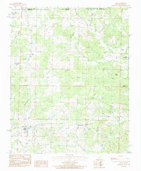
1984 Map of Viola
USGS Topo · Published 1984About this map
Viola serves as the primary hub of this Ozark borderland area, situated near the headwaters of Big Creek and Davenport Creek. The terrain is defined by a series of prominent peaks, including Shaw Knob and Wildcat Knob, which overlook a network of winding watercourses like Trace Creek and Greasy Branch. Small communities and agricultural pockets are scattered throughout, with Sturkie and Moody marking the more remote corners of the landscape.
Find a feature on this map
32 named features on this map. Tap any name to fly to it.
Don’t see what you’re looking for? This feature index may not catch every label — zoom into the map to look around manually.
Map Details
Editions of this 1984 Viola Map
This is the sole edition of this map. No revisions or reprints were ever made.
Other maps of this area

1890 · Mountain Home
USGS Topo · 1:125,000

1891 · Mountain Home
USGS Topo · 1:125,000

1894 · Mountain Home
USGS Topo · 1:125,000

1944 · West Plains
USGS Topo · 1:62,500

1944 · Cureall
USGS Topo · 1:62,500

1945 · Harrison
USGS Topo · 1:250,000

1946 · West Plains
USGS Topo · 1:62,500

1946 · Cureall
USGS Topo · 1:62,500

1949 · Harrison
USGS Topo · 1:250,000

1950 · Salem
USGS Topo · 1:62,500