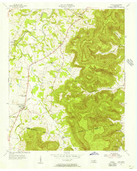
1955 Map of Viola
USGS Topo · Published 1956About this map
The town of Viola serves as the hub for this mid-century topographic record, which details the complex interface between the Highland Rim and the rising Cumberland Plateau. The landscape is defined by deep hollows and coves, including Solomon Hollow and Northcutts Cove, which carve into the eastern heights of Ben Lomond Mtn. Settlement patterns follow the valley floors near Hickory Creek, with a notable density of rural institutions that mark the social fabric of the era.
Find a feature on this map
34 named features on this map. Tap any name to fly to it.
Don’t see what you’re looking for? This feature index may not catch every label — zoom into the map to look around manually.
Map Details
Editions of this 1955 Viola Map
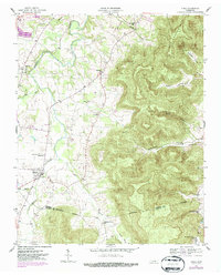
2 editions found
Other maps of this area

1893 · Mc Minnville
USGS Topo · 1:125,000

1895 · Mc Minnville
USGS Topo · 1:125,000

1895 · Sewanee
USGS Topo · 1:125,000

1936 · Morrison
USGS Topo · 1:24,000

1936 · Hillsboro
USGS Topo · 1:24,000

1936 · Cane Hollow
USGS Topo · 1:24,000

1943 · Mc Minnville
USGS Topo · 1:100,000

1952 · Centertown
USGS Topo · 1:24,000

1953 · Chattanooga
USGS Topo · 1:250,000

1953 · Centertown
USGS Topo · 1:24,000