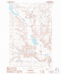
1986 Map of Virden
USGS Topo · Published 1986About this map
The Prairie Dell Oil and Gas Field dominates the high plains landscape of this Toole County region, illustrating the mid-1980s energy economy of northern Montana. Near the southern edge, the community of Shelby serves as a vital transportation hub, situated at the junction of the Burlington Northern railroad lines and the local Shelby Airport. The map documents a blend of industrial infrastructure and traditional ranching, with the Wiegand Ranch, Holstad Ranch, and Dumas Ranch spaced across the terrain.
Find a feature on this map
14 named features on this map. Tap any name to fly to it.
Don’t see what you’re looking for? This feature index may not catch every label — zoom into the map to look around manually.
Map Details
Editions of this 1986 Virden Map
This is the sole edition of this map. No revisions or reprints were ever made.
Other maps of this area

1909 · Cut Bank
USGS Topo · 1:125,000

1912 · Cut Bank
USGS Topo · 1:125,000

1920 · Dupuyer
USGS Topo · 1:125,000

1920 · Conrad
USGS Topo · 1:125,000

1934 · Valier
USGS Topo · 1:62,500

1937 · Valier
USGS Topo · 1:62,500

1943 · Shelby
USGS Topo · 1:62,500

1954 · Shelby
USGS Topo · 1:250,000

1958 · Shelby
USGS Topo · 1:250,000

1960 · Cut Bank
USGS Topo · 1:250,000