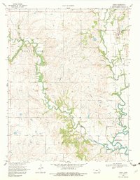
1969 Map of Virgil
USGS Topo · Published 1982About this map
Virgil stands as the primary settlement in this Kansas landscape, situated near the meandering path of the Verdigris River and Virgil Creek. The region’s economic character is defined by the extensive petroleum extraction infrastructure of the late 1960s, evidenced by the Seeley Wick Oil Field, Hinchman Oil Field, and Quincy Oil Field. These fields are connected by the Quincy Pipeline, which cuts across the terrain alongside numerous Oil Wells and scattered Gravel Pits. Local history and genealogy are anchored by features like the Virgil Cem and Pleasant Valley Cem. The map captures a transition in water management and land use, showing the upper reaches of Toronto Lake where the river system begins to widen. Away from the water, the land is divided into townships including Janesville, Lane, and Quincy, illustrating the rural grid typical of the Kansas prairie during this era.
Find a feature on this map
21 named features on this map. Tap any name to fly to it.
Don’t see what you’re looking for? This feature index may not catch every label — zoom into the map to look around manually.
Map Details
Editions of this 1969 Virgil Map
2 editions found
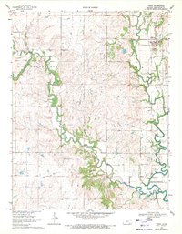
Other maps of this area

1885 · Burlington
USGS Topo · 1:125,000

1885 · Eureka
USGS Topo · 1:125,000

1886 · Fredonia
USGS Topo · 1:125,000

1888 · Emporia
USGS Topo · 1:125,000

1888 · Eureka
USGS Topo · 1:125,000

1894 · Emporia
USGS Topo · 1:125,000

1894 · Fredonia
USGS Topo · 1:125,000

1894 · Burlington
USGS Topo · 1:125,000

1894 · Eureka
USGS Topo · 1:125,000

1947 · Lawrence
USGS Topo · 1:250,000