
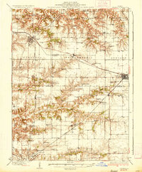
1936 Map of Virginia
USGS Topo · Published 1936About this map
Virginia and Ashland anchor this 1930s landscape where the agricultural plains of central Illinois meet the breaks of the Sangamon Valley. The rail network of the Baltimore and Ohio and the Alton lines provided the primary economic arteries for grain and livestock transport, connecting small shipping points like Philadelphia, Literberry, and Prentice. The map reveals an exceptionally dense system of rural education, with dozens of family-named schoolhouses such as Science Hill Sch, Brush College Sch, and Crows Point Sch distributed at nearly every section interval to serve the farmstead population.
Find a feature on this map
79 named features on this map. Tap any name to fly to it.
Don’t see what you’re looking for? This feature index may not catch every label — zoom into the map to look around manually.
Map Details
Editions of this 1936 Virginia Map
2 editions found
Other maps of this area

1909 · Tallula
USGS Topo · 1:62,500

1924 · Winchester
USGS Topo · 1:48,000

1924 · Waverly
USGS Topo · 1:62,500

1926 · Beardstown
USGS Topo · 1:62,500

1926 · Winchester
USGS Topo · 1:62,500

1926 · Waverly
USGS Topo · 1:62,500

1929 · Arenzville
USGS Topo · 1:62,500

1930 · Chandlerville
USGS Topo · 1:62,500

1932 · Arenzville
USGS Topo · 1:62,500

1932 · Chandlerville
USGS Topo · 1:62,500