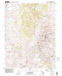
1994 Map of Virginia City
USGS Topo · Published 1994About this map
Virginia City anchors this 1994 survey of the Comstock Lode district, showing the dense industrial and civic footprint of one of Nevada's most significant mining regions. The map meticulously documents the legacy of the silver boom, tracing the Sutro Tunnel and the winding route of the Virginia and Truckee Railroad. The urban landscape is marked by historic institutions like the 4th Ward Sch Museum and the Catholic Ch, alongside a concentration of fraternal and religious burial grounds including the Masonic Cem, Hebrew Cem, and Fireman Cem. Outside the main settlements of Gold Hill and Silver City, the terrain of the Virginia Range is heavily scarred by massive mining operations. Named shafts and pits such as the Savage Mine, Chollar Mine, and the deep Utah Shaft illustrate the subsurface intensity of the era, while topographic features like Mt Davidson and Spanish Ravine define the steep, high-elevation environment of the high desert.
Find a feature on this map
127 named features on this map. Tap any name to fly to it.
Don’t see what you’re looking for? This feature index may not catch every label — zoom into the map to look around manually.
Map Details
Editions of this 1994 Virginia City Map
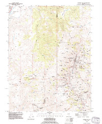
2 editions found
Other maps of this area

1891 · Carson
USGS Topo · 1:125,000

1893 · Carson
USGS Topo · 1:125,000

1950 · Virginia City
USGS Topo · 1:62,500

1950 · Mt. Rose
USGS Topo · 1:62,500

1952 · Mt. Rose
USGS Topo · 1:62,500

1952 · Virginia City
USGS Topo · 1:62,500

1956 · Dayton
USGS Topo · 1:62,500

1956 · Carson City
USGS Topo · 1:62,500

1957 · Reno
USGS Topo · 1:250,000

1959 · Reno
USGS Topo · 1:250,000