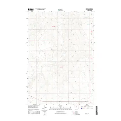
2015 Map of Virginia
USGS Topo · Published 2015About this map
Virginia serves as the primary point of reference in this section of Dewey County, where the landscape is defined by the intricate dendritic drainage of the Missouri River plateau. The settlement is situated near the upper reaches of Virgin Cr, which snakes southward through the center of the quadrangle. This 2015 survey illustrates the modern rural infrastructure of the region, anchored by county roads such as CR-14f and CR-14g. The topography is characterized by a network of breaks and draws feeding into watercourses like Left Hand Bear Cr in the northwest and Buffalo Cr to the northeast. While largely open rangeland today, the map preserves the legal framework of the Public Land Survey System, showing the township boundaries of t15n r29e and its neighbors which have governed land ownership in this part of South Dakota since the homesteading era.
Find a feature on this map
11 named features on this map. Tap any name to fly to it.
Don’t see what you’re looking for? This feature index may not catch every label — zoom into the map to look around manually.
Map Details
Editions of this 2015 Virginia Map
This is the sole edition of this map. No revisions or reprints were ever made.
Other maps of this area

1951 · Virginia
USGS Topo · 1:24,000

1951 · La Plant
USGS Topo · 1:24,000

1951 · Promise
USGS Topo · 1:24,000

1952 · Trail City SW
USGS Topo · 1:24,000

1953 · McIntosh
USGS Topo · 1:250,000

1958 · McIntosh
USGS Topo · 1:250,000

1968 · Moreau
USGS Topo · 1:24,000

1969 · Patch Skin Buttes SW
USGS Topo · 1:24,000

1970 · Patch Skin Buttes
USGS Topo · 1:24,000
1981 · Stove Creek
USGS Topo · 1:24,000