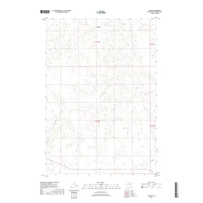
2017 Map of Virginia
USGS Topo · Published 2017About this map
Virginia serves as the central point of reference in this Dewey County landscape, situated amidst the complex drainage patterns of the Missouri River plateau. The area is defined by the winding paths of several watercourses, most notably Virgin Cr, which cuts through the township alongside E Fork Beaver Cr and Buffalo Cr. To the west, the headwaters of Left Hand Bear Cr mark the higher elevations of the local terrain.
Find a feature on this map
12 named features on this map. Tap any name to fly to it.
Don’t see what you’re looking for? This feature index may not catch every label — zoom into the map to look around manually.
Map Details
Editions of this 2017 Virginia Map
This is the sole edition of this map. No revisions or reprints were ever made.
Other maps of this area

1951 · Virginia
USGS Topo · 1:24,000

1951 · La Plant
USGS Topo · 1:24,000

1951 · Promise
USGS Topo · 1:24,000

1952 · Trail City SW
USGS Topo · 1:24,000

1953 · McIntosh
USGS Topo · 1:250,000

1958 · McIntosh
USGS Topo · 1:250,000

1968 · Moreau
USGS Topo · 1:24,000

1969 · Patch Skin Buttes SW
USGS Topo · 1:24,000

1970 · Patch Skin Buttes
USGS Topo · 1:24,000
1981 · Stove Creek
USGS Topo · 1:24,000