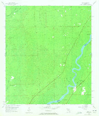
1954 Map of Vista
USGS Topo · Published 1972About this map
The Suwannee River carves a sweeping path along the border of Dixie and Levy counties, serving as the central artery for small riverfront outposts like Fowler Bluff and Vista. This mid-century landscape is dominated by the sprawling California Swamp to the west, a dense network of wetlands interspersed with features like Lime Sink and Otter Sink Camp. The reliance on the river for local activity is evident in the presence of several established landings, including Jack Landing and Week Landing, which provided essential water access points for the remote communities in this part of Florida. On higher ground, the Putman Lookout Tower stands as a sentinel over the timber and swamp lands. For those tracing local families, the map identifies the Keen Cem near the river, while small settlements like Yellow Jacket mark the edge of the wetlands, illustrating the sparse but deliberate human footprint in this riverine environment.
Find a feature on this map
17 named features on this map. Tap any name to fly to it.
Don’t see what you’re looking for? This feature index may not catch every label — zoom into the map to look around manually.
Map Details
Editions of this 1954 Vista Map
4 editions found
Other maps of this area

1954 · Eugene
USGS Topo · 1:24,000

1954 · Cross City SW
USGS Topo · 1:24,000

1954 · Suwannee
USGS Topo · 1:24,000

1954 · Manatee Springs
USGS Topo · 1:24,000

1954 · Chiefland SW
USGS Topo · 1:24,000

1954 · Vista
USGS Topo · 1:24,000

1954 · East Pass
USGS Topo · 1:24,000

1954 · Gainesville
USGS Topo · 1:250,000

1955 · Shired Island
USGS Topo · 1:24,000

1958 · Gainesville
USGS Topo · 1:250,000