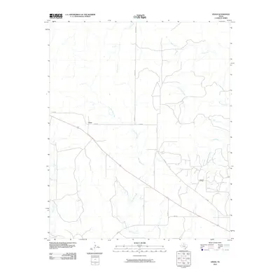
2010 Map of Vivian
USGS Topo · Published 2010About this map
The community of Vivian sits at the junction of Co RD 480 and Co RD 482 in a region defined by its winding seasonal drainages and early 21st-century energy production. The landscape is deeply carved by a network of creeks including Blue Hole Creek, Cactus Creek, and Half Circle Creek, which dictate the placement of local thoroughfares like Mormon Rd. These waterways reveal the underlying topography of the eastern Rolling Plains, where the drainage patterns of Canal Creek and Cedar Creek shape the rural road grid.
Find a feature on this map
16 named features on this map. Tap any name to fly to it.
Don’t see what you’re looking for? This feature index may not catch every label — zoom into the map to look around manually.
Map Details
Editions of this 2010 Vivian Map
This is the sole edition of this map. No revisions or reprints were ever made.
Other maps of this area

1927 · Quanah 3-a
USGS Topo · 1:48,000

1927 · Quanah 3-b
USGS Topo · 1:48,000

1932 · Vivian
USGS Topo · 1:62,500

1954 · Lubbock
USGS Topo · 1:250,000

1954 · Plainview
USGS Topo · 1:250,000

1954 · Wichita Falls
USGS Topo · 1:250,000

1955 · Lawton
USGS Topo · 1:250,000

1958 · Wichita Falls
USGS Topo · 1:250,000

1958 · Plainview
USGS Topo · 1:250,000

1960 · Teacup Mountain
USGS Topo · 1:62,500