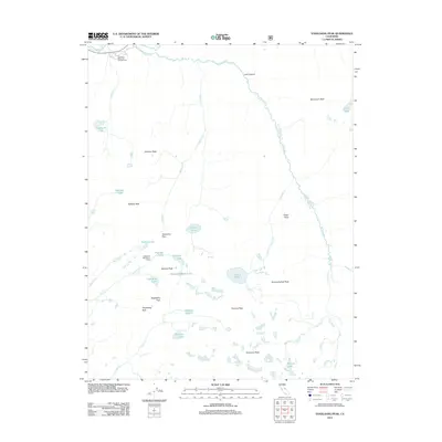
2012 Map of Vogelsang Peak
USGS Topo · Published 2012About this map
Vogelsang High Sierra Camp and the high alpine basins of the Sierra Nevada define this 2012 survey. The landscape is dominated by glacial topography, featuring high-elevation water bodies such as Ireland Lake, Elizabeth Lake, and Vogelsang Lake. Major granite summits including Parsons Peak, Amelia Earhart Peak, and the namesake Vogelsang Peak ring the high passes. The Lyell Fork of the Tuolumne River winds through the expansive Lyell Canyon, a key drainage that shapes the northern reach of the map. This area serves as a significant junction for high-country travel, centered around the Tuolumne Meadows Campground and the network of trails crossing Tuolumne Pass and Vogelsang Pass. The mapping shows the intricate hydrography of the region, from the headwaters of Rafferty Cr to the high basins containing Bernice Lake and Gallison Lake.
Find a feature on this map
37 named features on this map. Tap any name to fly to it.
Don’t see what you’re looking for? This feature index may not catch every label — zoom into the map to look around manually.
Map Details
Editions of this 2012 Vogelsang Peak Map
This is the sole edition of this map. No revisions or reprints were ever made.
Other maps of this area

1901 · Mt. Lyell
USGS Topo · 1:125,000

1947 · Mariposa
USGS Topo · 1:250,000

1948 · Mariposa
USGS Topo · 1:250,000

1953 · Merced Peak
USGS Topo · 1:62,500

1953 · Mono Craters
USGS Topo · 1:62,500

1953 · Devils Postpile
USGS Topo · 1:62,500

1956 · Tuolumne Meadows
USGS Topo · 1:62,500

1957 · Mariposa
USGS Topo · 1:250,000

1963 · Mariposa
USGS Topo · 1:250,000
1976 · Yosemite Valley
USGS Topo · 1:100,000