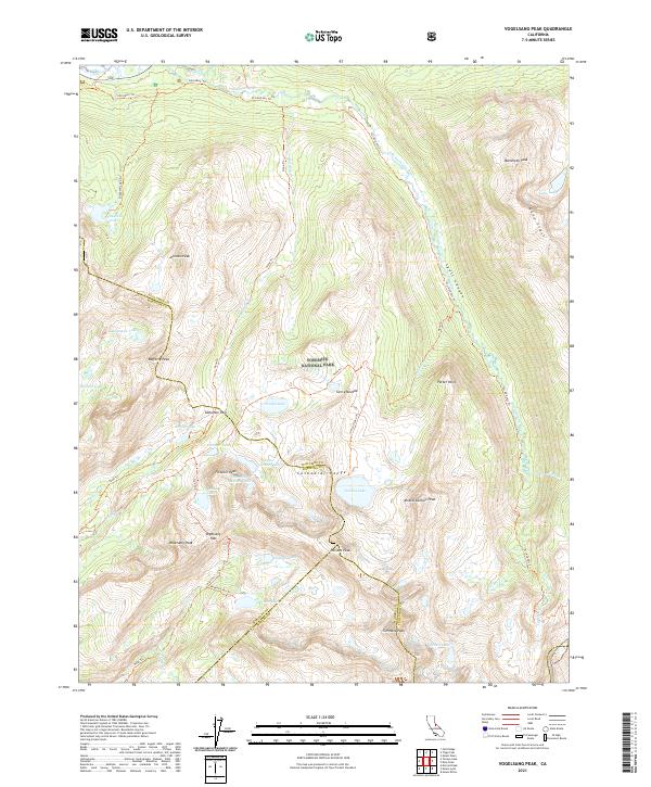
2021 Map of Vogelsang Peak
USGS Topo · Published 2021About this map
Yosemite National Park dominates this landscape, defined by the high-elevation peaks of the Cathedral Range and the Kuna Crest. The topography is characterized by a high concentration of alpine lakes, including Vogelsang Lake, Evelyn Lake, and Ireland Lake, which feed the headwaters of numerous creeks like Rafferty Cr and Fletcher Cr. These water systems eventually flow into the Lyell Canyon, through which the Tuolumne Wild and Scenic River winds southward. The high-country connectivity is maintained by a network of established paths, most notably the John Muir Trl and the combined Pct And Jmt Trl, providing passage through the Tuolumne Pass and Vogelsang Pass. Named summits such as Vogelsang Peak, Simmons Peak, and Amelia Earhart Peak provide prominent landmarks across the triple-border intersection of Tuolumne, Mariposa, and Madera counties.
Find a feature on this map
52 named features on this map. Tap any name to fly to it.
Don’t see what you’re looking for? This feature index may not catch every label — zoom into the map to look around manually.
Map Details
Editions of this 2021 Vogelsang Peak Map
This is the sole edition of this map. No revisions or reprints were ever made.
Other maps of this area

1901 · Mt. Lyell
USGS Topo · 1:125,000

1947 · Mariposa
USGS Topo · 1:250,000

1948 · Mariposa
USGS Topo · 1:250,000

1953 · Merced Peak
USGS Topo · 1:62,500

1953 · Mono Craters
USGS Topo · 1:62,500

1953 · Devils Postpile
USGS Topo · 1:62,500

1956 · Tuolumne Meadows
USGS Topo · 1:62,500

1957 · Mariposa
USGS Topo · 1:250,000

1963 · Mariposa
USGS Topo · 1:250,000
1976 · Yosemite Valley
USGS Topo · 1:100,000