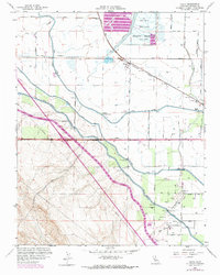
1960 Map of Volta
USGS Topo · Published 1972About this map
Water management and agricultural infrastructure define this landscape on the edge of the San Joaquin Valley. The community of Volta sits at a junction of the Southern Pacific railroad and San Luis Road, while the smaller settlement of Trent appears to the east. Extensive irrigation works dominate the geography, notably the massive California Aqueduct and the Delta-Mendota Canal, which cut through the terrain alongside the Delta-Mendota Outside Canal. To the north, the Holding Reservoir and numerous Duck Ponds indicate the importance of managed wetlands and water storage. Local landmarks like the Los Banos Odd Fellows Grove and the Los Banos Fire Control Station provide specific points of interest for local history. The map also traces various gaging stations and gravel pits, reflecting the area's utility-focused development near Badger Flat and the flowing San Luis Creek.
Find a feature on this map
35 named features on this map. Tap any name to fly to it.
Don’t see what you’re looking for? This feature index may not catch every label — zoom into the map to look around manually.
Map Details
Editions of this 1960 Volta Map
4 editions found
Other maps of this area

1913 · Panoche
USGS Topo · 1:125,000

1919 · San Luis Ranch
USGS Topo · 1:31,680

1919 · Ingomar
USGS Topo · 1:31,680

1920 · Pacheco Pass
USGS Topo · 1:62,500

1920 · Carrisalito Spring
USGS Topo · 1:31,680

1921 · Volta
USGS Topo · 1:31,680

1921 · Los Banos
USGS Topo · 1:31,680

1922 · Charleston School
USGS Topo · 1:31,680

1922 · Quien Sabe
USGS Topo · 1:62,500

1922 · San Luis Creek
USGS Topo · 1:31,680