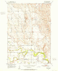
1951 Map of Volunteer
USGS Topo · Published 1953About this map
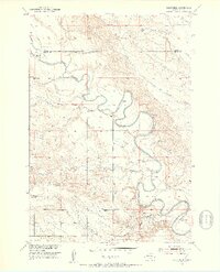
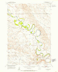
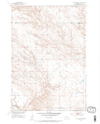
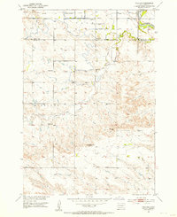
The Belle Fourche River dominates this early 1950s landscape, winding through a series of dramatic meanders along the Butte Co Meade Co border. This area, mapped as part of the Department of the Interior's Missouri River Basin development program, reveals a rural network of small schools and creek drainages that sustained the local ranching community. Educational hubs like Wetz Sch, Meyer Sch, and Fourmile Sch are spaced across the terrain, serving the scattered farmsteads of the era. The small settlement of Volunteer sits in the southeast corner near Butte Creek, while the presence of a Footbridge over a river bend and several Gravel Pits point to the local infrastructure and land use during this period of mid-century growth in the western Dakotas.
Find a feature on this map
12 named features on this map. Tap any name to fly to it.
Don’t see what you’re looking for? This feature index may not catch every label — zoom into the map to look around manually.
Map Details
Editions of this 1951 Volunteer Map
3 editions found

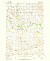
Other maps of this area

1893 · Rapid
USGS Topo · 1:125,000

1898 · Rapid
USGS Topo · 1:125,000

1903 · Rapid
USGS Topo · 1:125,000

1906 · Vale
USGS Topo · 1:62,500

1913 · Newell
USGS Topo · 1:125,000
1951 · Volunteer
USGS Topo · 1:24,000
1951 · Volunteer SE
USGS Topo · 1:24,000
1951 · Vale SE
USGS Topo · 1:24,000
1951 · Vale NE
USGS Topo · 1:24,000
1951 · Vale
USGS Topo · 1:62,500