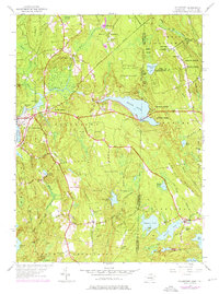
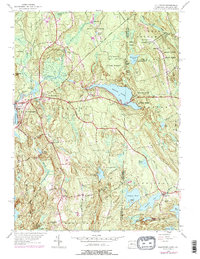
1953 Map of Voluntown
USGS Topo · Published 1976About this map
The Connecticut-Rhode Island border cuts through a landscape defined by state forests and sprawling water bodies in this mid-century topographic record. Centered on Voluntown, the map illustrates a region transitioning from agricultural roots toward conservation and recreation, evidenced by the extensive Pachaug State Forest and the Beach Pond State Park. Settlement patterns are concentrated at small crossroads like Rockville and Escoheag, while the interior is dotted with local landmarks such as Mount Misery and the Kennedy Sch.
Find a feature on this map
64 named features on this map. Tap any name to fly to it.
Don’t see what you’re looking for? This feature index may not catch every label — zoom into the map to look around manually.
Map Details
Editions of this 1953 Voluntown Map
5 editions found
Other maps of this area

1889 · Stonington
USGS Topo · 1:62,500

1889 · Charlestown
USGS Topo · 1:62,500

1889 · Moosup
USGS Topo · 1:62,500

1890 · Kent
USGS Topo · 1:62,500

1893 · Moosup
USGS Topo · 1:62,500

1893 · Stonington
USGS Topo · 1:62,500

1894 · Kent
USGS Topo · 1:62,500

1919 · Charlestown
USGS Topo · 1:62,500

1920 · Moosup
USGS Topo · 1:62,500

1921 · Charlestown
USGS Topo · 1:62,500