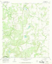
1967 Map of Voss
USGS Topo · Published 1969About this map
Voss sits at the northern edge of this West Texas landscape, where the drainage systems of central Coleman County converge toward the river. The southern boundary is defined by the winding course of the Colorado R at Horseshoe Bend, where the terrain begins to transition across the county line into Concho County. This 1960s survey documents a landscape dominated by ranching and resource extraction, evidenced by the numerous Gravel Pit and Gravel Pits distributed across the plains.
Find a feature on this map
13 named features on this map. Tap any name to fly to it.
Don’t see what you’re looking for? This feature index may not catch every label — zoom into the map to look around manually.
Map Details
Editions of this 1967 Voss Map
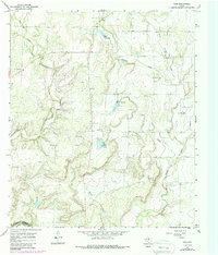
2 editions found
Other maps of this area

1887 · Coleman
USGS Topo · 1:125,000

1889 · Coleman
USGS Topo · 1:125,000

1892 · Eden
USGS Topo · 1:125,000

1892 · Ballinger
USGS Topo · 1:125,000

1894 · Brady
USGS Topo · 1:125,000

1896 · Eden
USGS Topo · 1:125,000

1924 · Eden 1-a
USGS Topo · 1:48,000

1925 · Brady 2-b
USGS Topo · 1:48,000

1925 · Ballinger 4-c
USGS Topo · 1:48,000

1928 · Waldrip
USGS Topo · 1:62,500