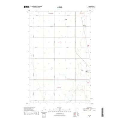
2017 Map of Voss
USGS Topo · Published 2017About this map
Minto and its immediate rural surroundings in Walsh County define the landscape of this Red River Valley survey. The settlement pattern follows a rigid section grid typical of North Dakota’s agricultural heartland, where small clusters like Voss and Kellogg are positioned at the intersections of county roads and historic rail alignments. To the east, the landing strip of the Minto Municipal Airport sits just outside the town limits, reflecting the modernization of transportation in this farming community. The terrain is notably flat, broken primarily by the winding path of the Forest River as it meanders through the southern sections. This watercourse introduces the only significant natural relief to the otherwise geometric layout of fields and section lines like 66th St NE and 150th Ave NE.
Find a feature on this map
35 named features on this map. Tap any name to fly to it.
Don’t see what you’re looking for? This feature index may not catch every label — zoom into the map to look around manually.
Map Details
Editions of this 2017 Voss Map
This is the sole edition of this map. No revisions or reprints were ever made.
Other maps of this area

1926 · Ardoch
USGS Topo · 1:62,500

1943 · Grafton
USGS Topo · 1:62,500

1952 · Thief River Falls
USGS Topo · 1:250,000

1956 · Thief River Falls
USGS Topo · 1:250,000

1957 · Thief River Falls
USGS Topo · 1:250,000

1960 · Grafton
USGS Topo · 1:24,000
1960 · Oakwood
USGS Topo · 1:24,000

1963 · Inkster NE
USGS Topo · 1:24,000

1963 · Veseleyville
USGS Topo · 1:24,000

1963 · Nash
USGS Topo · 1:24,000