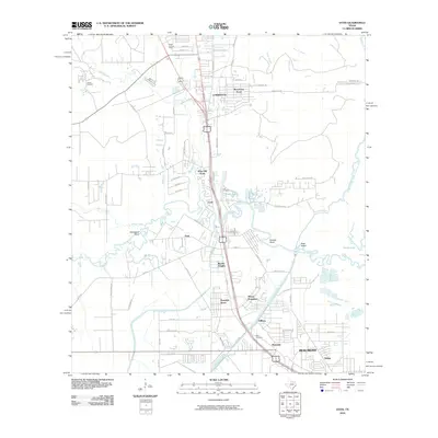
2010 Map of Voth
USGS Topo · Published 2010About this map
Pine Island Bayou and its winding tributaries dominate this landscape north of Beaumont, where the intricate waterways of Horseshoe Bend and Suicide Bend contrast with the modern residential expansion of Lumberton. The transition from industrial infrastructure to residential clusters is evident in the presence of the Ariola Oil Field and the Ariola Lookout Tower near the northern boundary.
Find a feature on this map
66 named features on this map. Tap any name to fly to it.
Don’t see what you’re looking for? This feature index may not catch every label — zoom into the map to look around manually.
Map Details
Editions of this 2010 Voth Map
This is the sole edition of this map. No revisions or reprints were ever made.
Other maps of this area

1926 · Lakeview
USGS Topo · 1:24,000

1926 · Vidor
USGS Topo · 1:24,000

1932 · Beaumont
USGS Topo · 1:62,500

1943 · Beaumont East
USGS Topo · 1:24,000

1954 · Beaumont
USGS Topo · 1:250,000

1955 · Silsbee
USGS Topo · 1:62,500

1955 · Kountze
USGS Topo · 1:62,500

1955 · Sour Lake
USGS Topo · 1:62,500

1957 · Beaumont
USGS Topo · 1:250,000
1960 · Beaumont West
USGS Topo · 1:24,000