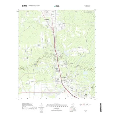
2019 Map of Voth
USGS Topo · Published 2019About this map
Lumberton and the northern reaches of Beaumont anchor this 2019 survey, where the dense suburban expansion of Southeast Texas meets the protected wetlands of the Big Thicket National Preserve. The landscape is defined by the winding course of Pine Island Bayou and the Lower Neches Valley Authority Canal, reflecting a region shaped by both its natural floodplains and large-scale water management. Smaller residential enclaves like Rose Hill Acres, Voth, and Bor-ley Heights are nestled among the drainages of Black Cr and Walker Branch. Genealogists will find the locations of Loeb Cem and Spell Cem particularly useful for identifying family sites near Loeb and Gilburg. The transition from the established neighborhoods of Mount Evergreen to the forested bends of Cooks Lake illustrates the persistent balance between urban growth and the coastal piney woods ecosystem.
Find a feature on this map
180 named features on this map. Tap any name to fly to it.
Don’t see what you’re looking for? This feature index may not catch every label — zoom into the map to look around manually.
Map Details
Editions of this 2019 Voth Map
This is the sole edition of this map. No revisions or reprints were ever made.
Other maps of this area

1926 · Lakeview
USGS Topo · 1:24,000

1926 · Vidor
USGS Topo · 1:24,000

1932 · Beaumont
USGS Topo · 1:62,500

1943 · Beaumont East
USGS Topo · 1:24,000

1954 · Beaumont
USGS Topo · 1:250,000

1955 · Silsbee
USGS Topo · 1:62,500

1955 · Kountze
USGS Topo · 1:62,500

1955 · Sour Lake
USGS Topo · 1:62,500

1957 · Beaumont
USGS Topo · 1:250,000
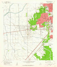
1960 · Beaumont West
USGS Topo · 1:24,000