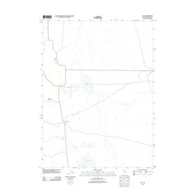
2011 Map of Vya
USGS Topo · Published 2011About this map
Vya serves as the focal point for this high-desert landscape in northern Washoe County, where sparse settlement and intermittent water define the terrain. The small community and nearby Powers Ranch are situated along the roadway network, representing the human footprint in an area characterized by seasonal drainage and alkaline basins. The hydrological patterns are particularly notable, featuring Fortynine Lake and Central Lake, which are typically dry beds or shallow playas depending on the season. Water sources like Twin Springs and drainages such as Secret Creek, South Creek, and the rugged North Bar Canyon provide critical reference points for land management and local history in this corner of Nevada. The map captures the quiet persistence of ranching life and the topographical features of the Great Basin as they appeared in the early 21st century.
Find a feature on this map
8 named features on this map. Tap any name to fly to it.
Don’t see what you’re looking for? This feature index may not catch every label — zoom into the map to look around manually.
Map Details
Editions of this 2011 Vya Map
This is the sole edition of this map. No revisions or reprints were ever made.
Other maps of this area

1889 · Long Valley
USGS Topo · 1:250,000

1954 · Vya
USGS Topo · 1:250,000

1958 · Vya
USGS Topo · 1:250,000

1962 · Vya
USGS Topo · 1:250,000

1966 · Massacre Lake NW
USGS Topo · 1:24,000

1966 · Vya
USGS Topo · 1:24,000
1966 · Carter Reservoir
USGS Topo · 1:24,000

1966 · Alkali Lake
USGS Topo · 1:24,000

1966 · Painted Point
USGS Topo · 1:24,000
1966 · Fortynine Mtn.
USGS Topo · 1:24,000