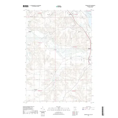
2019 Map of Wabasha South
USGS Topo · Published 2019About this map
The Zumbro River snakes through the heart of this landscape, its path defined by a series of sloughs including Tushaus Slough and Fry Slough. The river’s complex hydrology is further marked by Albertson Slough and Pine Slough, reflecting a lowland drainage pattern that borders elevations like Greenfield Hill and Wabasha Hill. Transportation and small-scale settlement center around the Soo Line rail corridor, which connects Midland Junction and Kellogg on the eastern edge of the survey.
Find a feature on this map
75 named features on this map. Tap any name to fly to it.
Don’t see what you’re looking for? This feature index may not catch every label — zoom into the map to look around manually.
Map Details
Editions of this 2019 Wabasha South Map
This is the sole edition of this map. No revisions or reprints were ever made.
Other maps of this area

1932 · Cochrane
USGS Topo · 1:62,500

1932 · Wabasha
USGS Topo · 1:62,500

1932 · Alma
USGS Topo · 1:62,500

1934 · Plainview
USGS Topo · 1:62,500

1934 · Cochrane
USGS Topo · 1:62,500

1937 · Cochrane
USGS Topo · 1:62,500

1938 · Plainview
USGS Topo · 1:62,500

1950 · Alma
USGS Topo · 1:62,500

1951 · Wabasha
USGS Topo · 1:62,500

1953 · Saint Paul
USGS Topo · 1:250,000