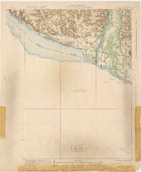
1932 Map of Wabasha
USGS Topo · Published 1932About this map
Pepin Prairie sits at the heart of this riverine landscape, where the widening of the Mississippi River into Lake Pepin meets the intricate delta of the Chippewa River. The map highlights a transition from the elevated bluffs of Sixteenth Bluff and Hicks Valley to the low-lying wetlands of the bottomlands. These river flats are defined by a complex network of waterways, including Wahcoutah Slough, Battle Slough, and Fortyacre Lake, which served as vital transport corridors before modern land reclamation.
Find a feature on this map
52 named features on this map. Tap any name to fly to it.
Don’t see what you’re looking for? This feature index may not catch every label — zoom into the map to look around manually.
Map Details
Editions of this 1932 Wabasha Map
2 editions found
Other maps of this area

1929 · Durand
USGS Topo · 1:62,500

1932 · Cochrane
USGS Topo · 1:62,500

1932 · Wabasha
USGS Topo · 1:62,500

1932 · Durand
USGS Topo · 1:62,500

1932 · Alma
USGS Topo · 1:62,500

1934 · Plainview
USGS Topo · 1:62,500

1934 · Cochrane
USGS Topo · 1:62,500

1935 · Rochester
USGS Topo · 1:48,000

1935 · Arkansaw
USGS Topo · 1:48,000

1937 · Cochrane
USGS Topo · 1:62,500