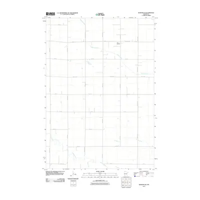
2010 Map of Wabasso SE
USGS Topo · Published 2010About this map
The Cottonwood River meanders across the southern portion of this Redwood County landscape, joined by the waters of Pell Creek amidst a geometric grid of rural roads. This section of Minnesota's agricultural heartland is defined by its deep hydrological network, where Sleepy Eye Creek cuts through the northern reaches and Coal Mine Creek flows to the east. The map records a quiet, rural character dominated by large-scale farming and long-established section lines, with the Saint Matthews Cemetery serving as a significant landmark for local history and genealogy. The road system, including thoroughfares like County Hwy-4 and County Hwy-86, illustrates the organized settlement pattern that has persisted for over a century, providing the framework for the region's agricultural economy and connectivity between isolated farmsteads.
Find a feature on this map
22 named features on this map. Tap any name to fly to it.
Don’t see what you’re looking for? This feature index may not catch every label — zoom into the map to look around manually.
Map Details
Editions of this 2010 Wabasso SE Map
This is the sole edition of this map. No revisions or reprints were ever made.
Other maps of this area

1953 · New Ulm
USGS Topo · 1:250,000

1957 · New Ulm
USGS Topo · 1:250,000

1958 · New Ulm
USGS Topo · 1:250,000

1967 · New Ulm
USGS Topo · 1:250,000

1967 · Wanda
USGS Topo · 1:24,000

1967 · Sanborn
USGS Topo · 1:24,000

1967 · Wabasso SE
USGS Topo · 1:24,000

1967 · Wabasso
USGS Topo · 1:24,000

1967 · Walnut Grove
USGS Topo · 1:24,000

1967 · Rowena
USGS Topo · 1:24,000